11/3/2021
Dozens of “visualizations” were posted to the California Redistricting Commission website this weekend.
We have hand drawn these visualizations from the commission PDF of their maps and converted each of these to our atlas format with overlays of cities, Congressional and legislative districts, included total population, ethnic counts, Citizen Voting Age ethnic totals and a final data table with some candidate and ballot measure results for the area defined in the visualization.
The following is a list of the maps which were provided. Click on any of the images below to view the full map packet.
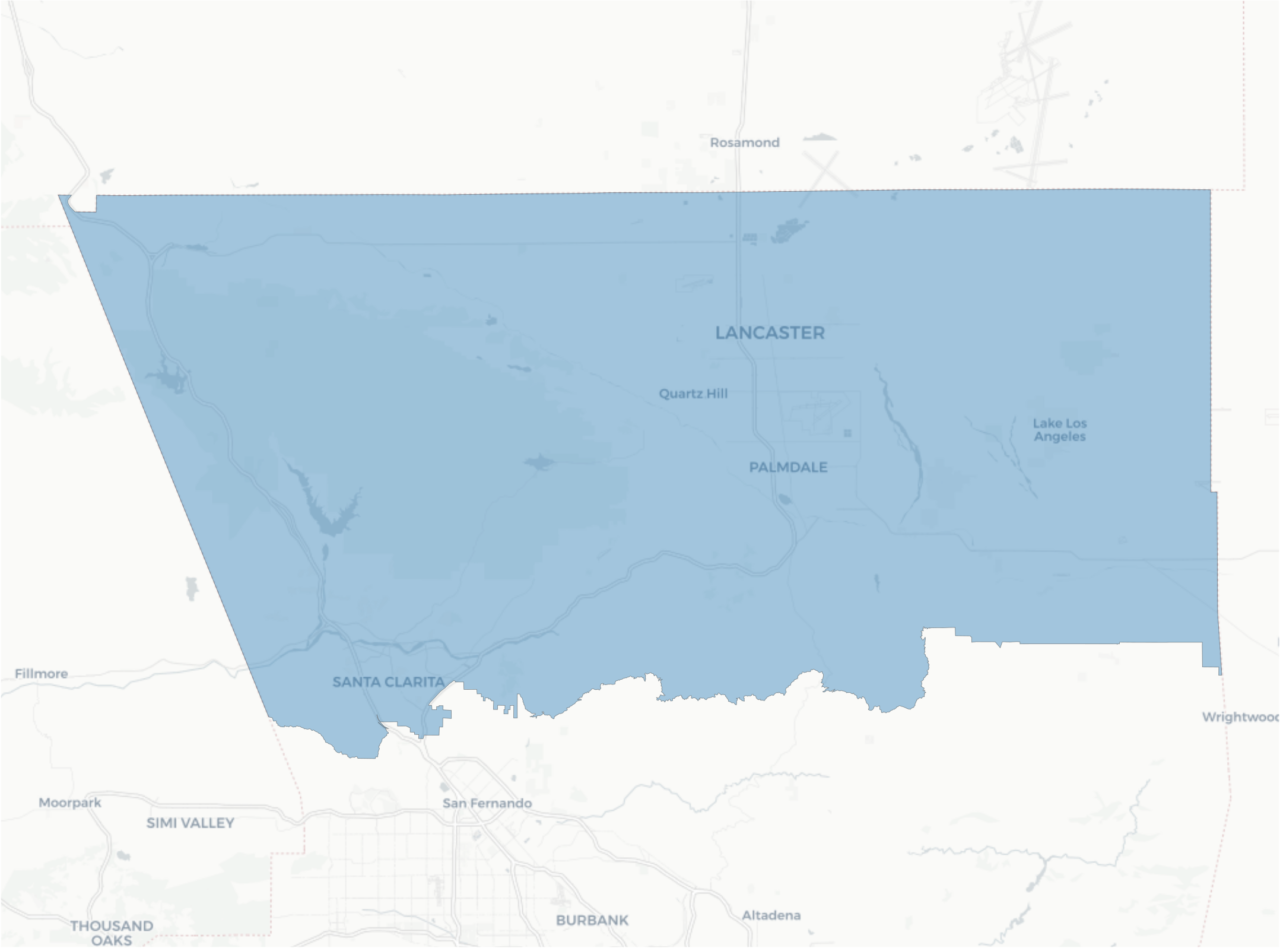
- Santa Clarita Valley and Antelope Valley.
- North L.A. County, including Santa Clarita Valley, Antelope Valley, and everything north of San Fernando Valley.
- Simi Valley, Santa Clarita Valley, and Antelope Valley
- Santa Clarita Valley, Antelope Valley, Rosamond, and Mojave.
- Santa Clarita Valley, Antelope Valley, Rosamond, Mojave, California City, Boron, and Edwards AFB.
- Antelope Valley, Rosamond, Mojave, California City, Boron, Edwards AFB and west to Tehachapi.
- Santa Clarita Valley, Antelope Valley, Victor Valley, Rosamond, Mojave, Edwards AFB, and California City.
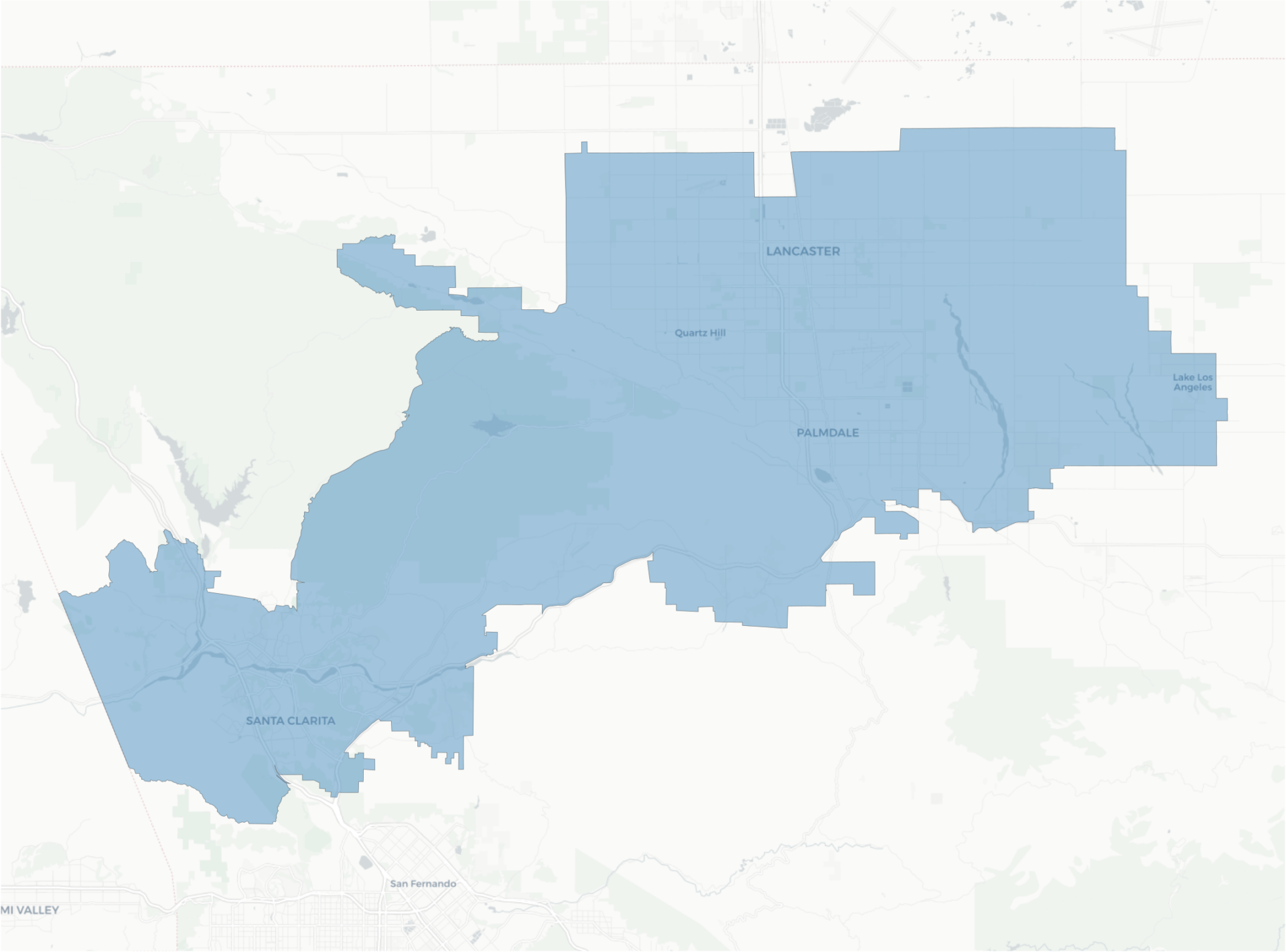
- Antelope Valley and Victor Valley.
- Antelope Valley, Victor Valley, and Barstow.
- Antelope Valley and Angeles Mountains.
- San Fernando Valley, City of L.A. and San Fernando only.
- San Fernando Valley (City of L.A. and San Fernando only) and Bell Canyon.
- San Fernando Valley: City of L.A., San Fernando, Burbank, Glendale, La Crescenta, La Cañada, Altadena and Pasadena. CRC Viz 1004, p15
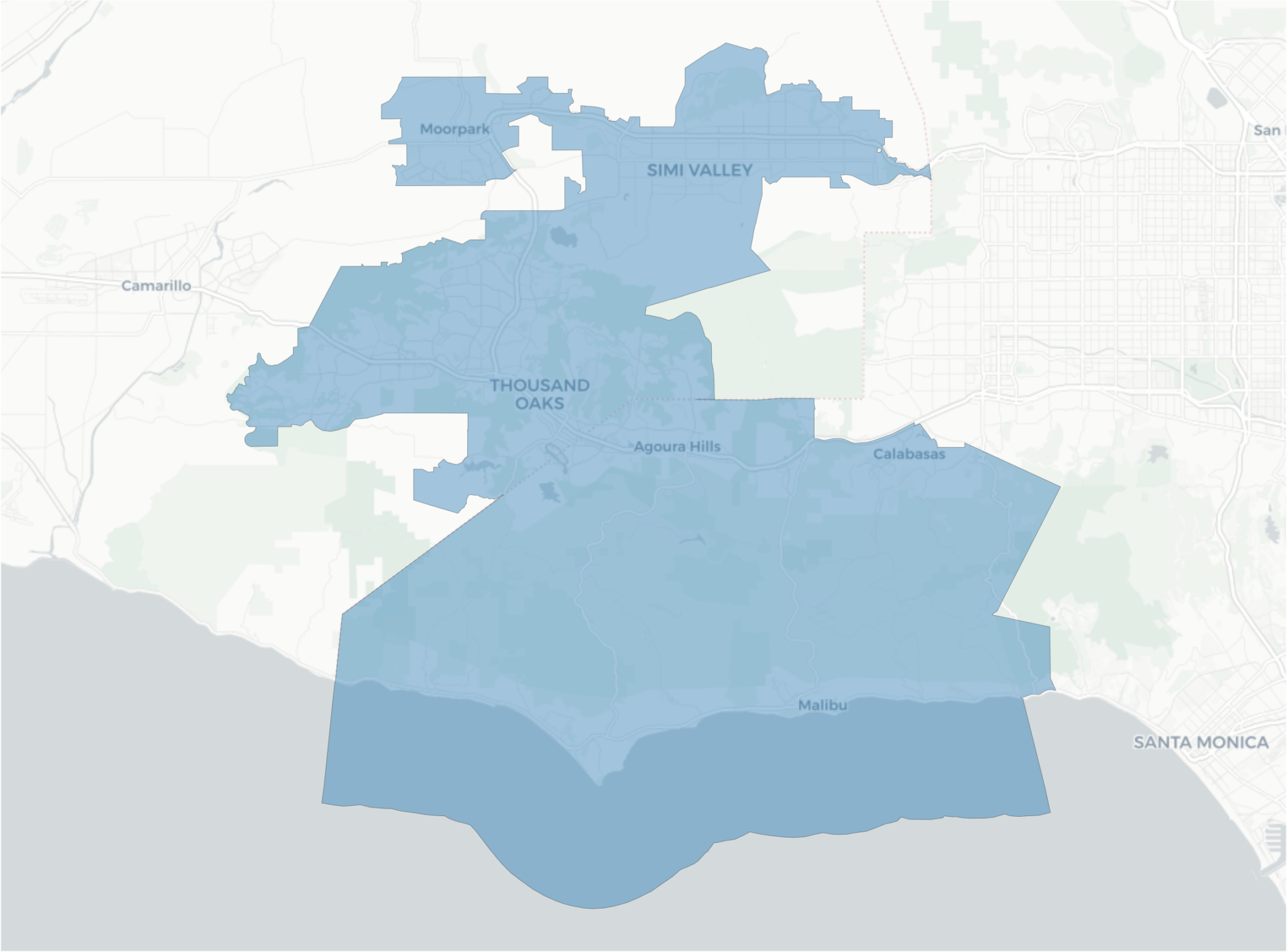
- Malibu, Topanga, Calabasas, Agoura Hills, Thousand Oaks, Oak Park, Simi Valley, and Moorpark.
- L.A. Coast from Malibu to Rancho Palos Verdes.
- L.A. Coast from Santa Monica to LAX, including Culver City.
- L.A. Coast from El Segundo to Rancho Palos Verdes.
- Torrance, Gardena, and Carson, as connected by I-405.
- Long Beach and Signal Hill.
- City of L.A.: El Sereno
- City of L.A.: Northeast neighborhoods, including Eagle Rock, Downtown L.A., Koreatown, Silver Lake, and Boyle Heights, and unincorporated East L.A.
- City of L.A.: Silver Lake to Eagle Rock to unincorporated East L.A.
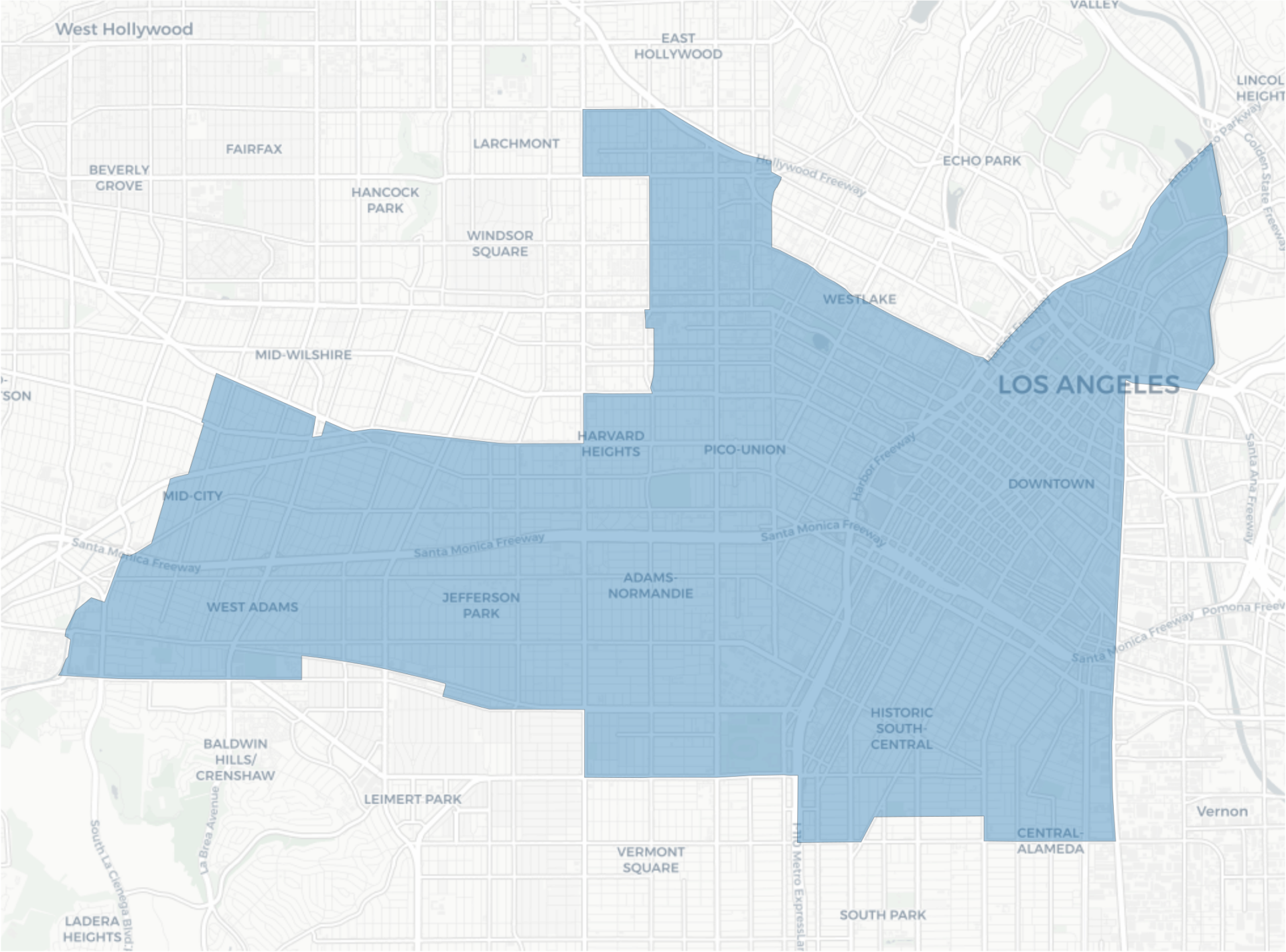
- City of L.A.: Central L.A., including West Adams NC and Mid-City NC.
- City of L.A.: Central L.A., South Central NC, Koreatown, and Downtown L.A.
- City of L.A.: Koreatown
- City of L.A.: South L.A. including Zapata King NC, Westmont, Watts NC, Walnut Park, and Florence-Graham.
- Gateway: Vernon to Southgate along I-710 and South L.A., including Watts NC and Florence-Graham.
- Gateway: I-605 corridor from Santa Fe Springs to Cerritos, including Artesia, Bellflower, Norwalk, and Downey.
- Gateway: Montebello, Pico Rivera, and Whittier.
- Gateway: I-5 corridor from Commerce to Cerritos, including Bellflower, Artesia, Norwalk, Downey, Bell Gardens, Bell, Vernon and Maywood.
- Gateway: Montebello to the west, South El Monte to the north, City of Industry to the east along Hwy 60, La Mirada to the south.
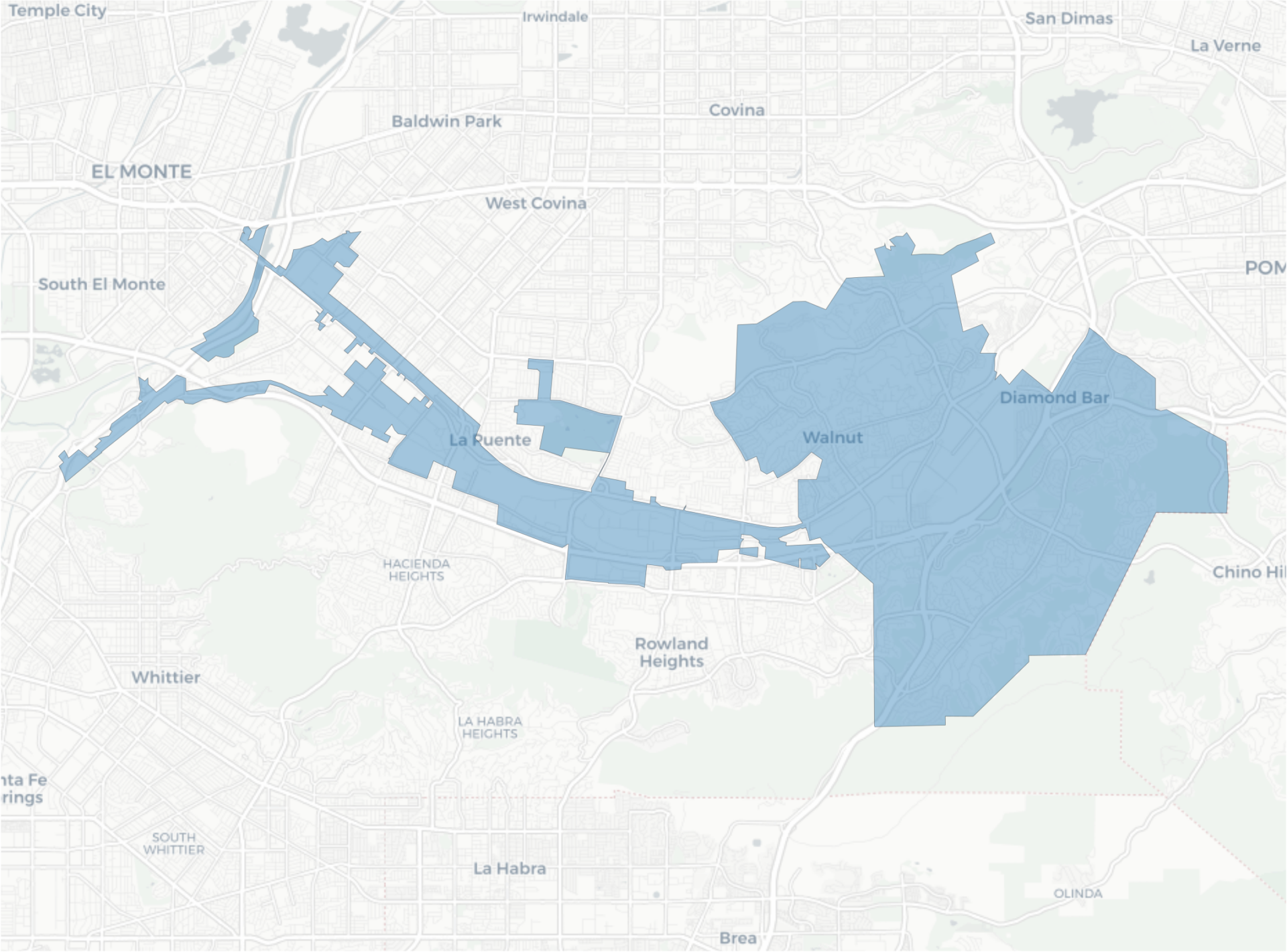
- Walnut, Diamond Bar, and City of Industry.
- Walnut, Diamond Bar, Chino Hills, and City of Industry.
- Walnut, Diamond Bar, West Covina, and City of Industry.
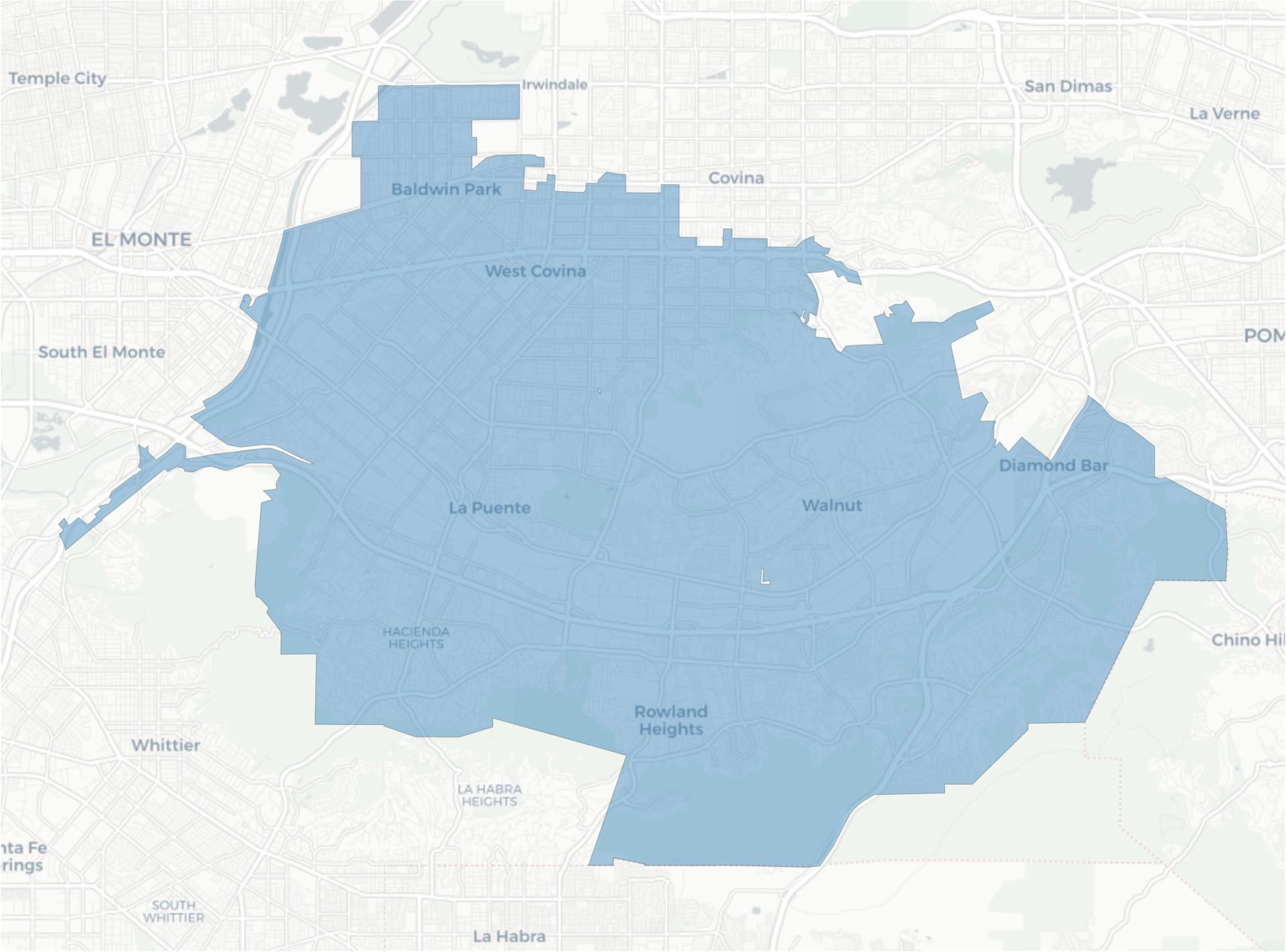
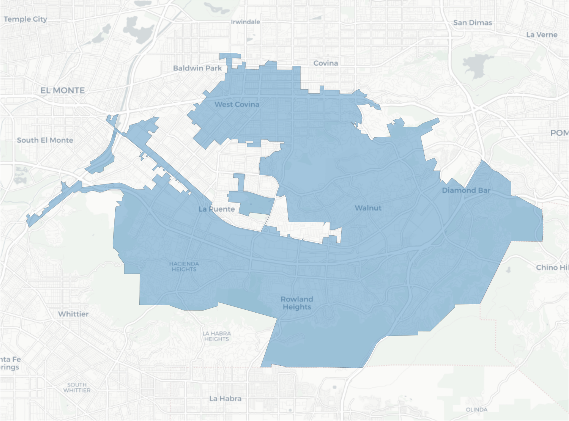
- Walnut, Diamond Bar, Rowland Heights, Hacienda Heights, West Covina, and City of Industry.
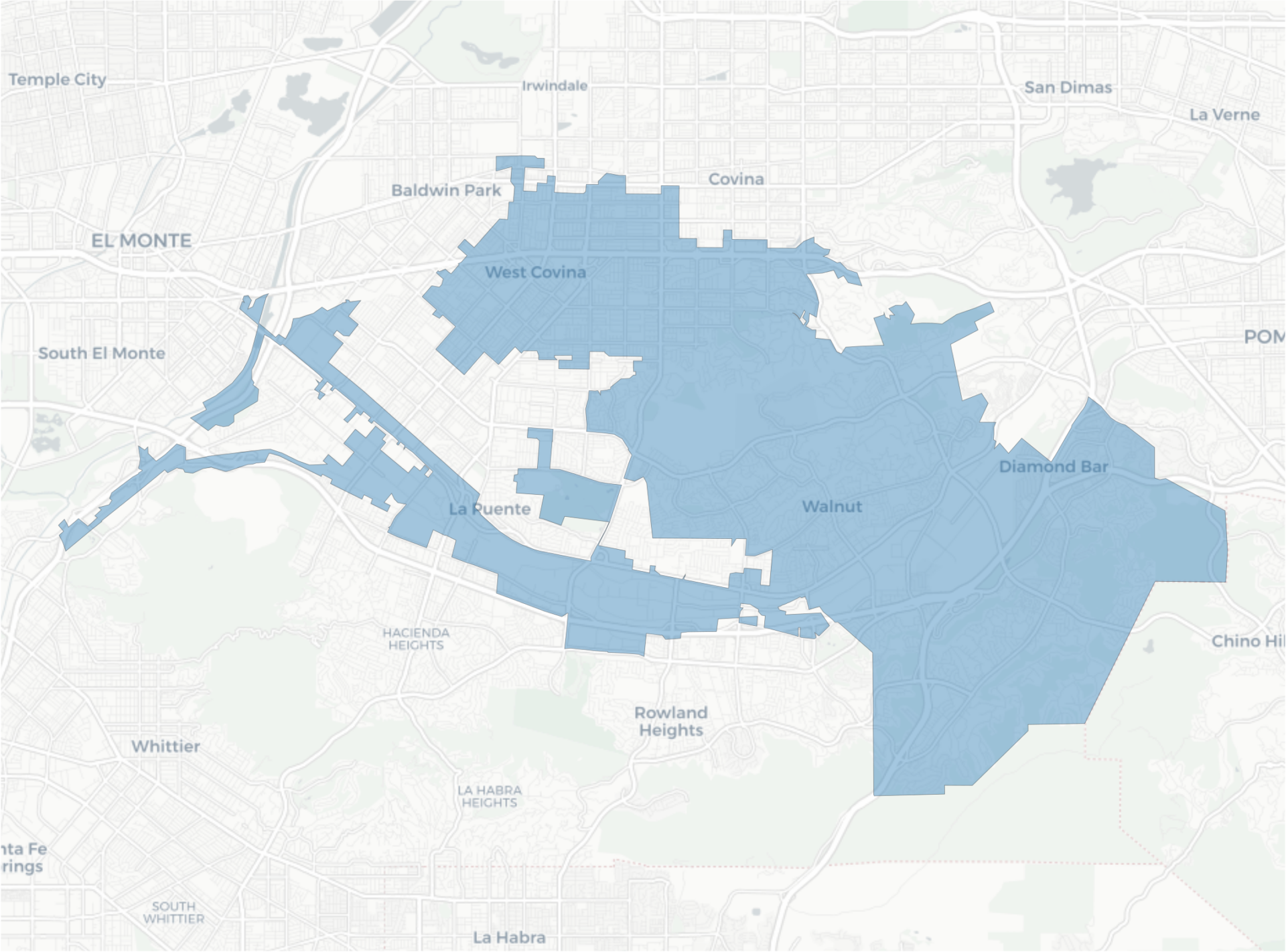
- Walnut, Diamond Bar, Rowland Heights, West Covina, La Puente, Baldwin Park, and City of Industry.
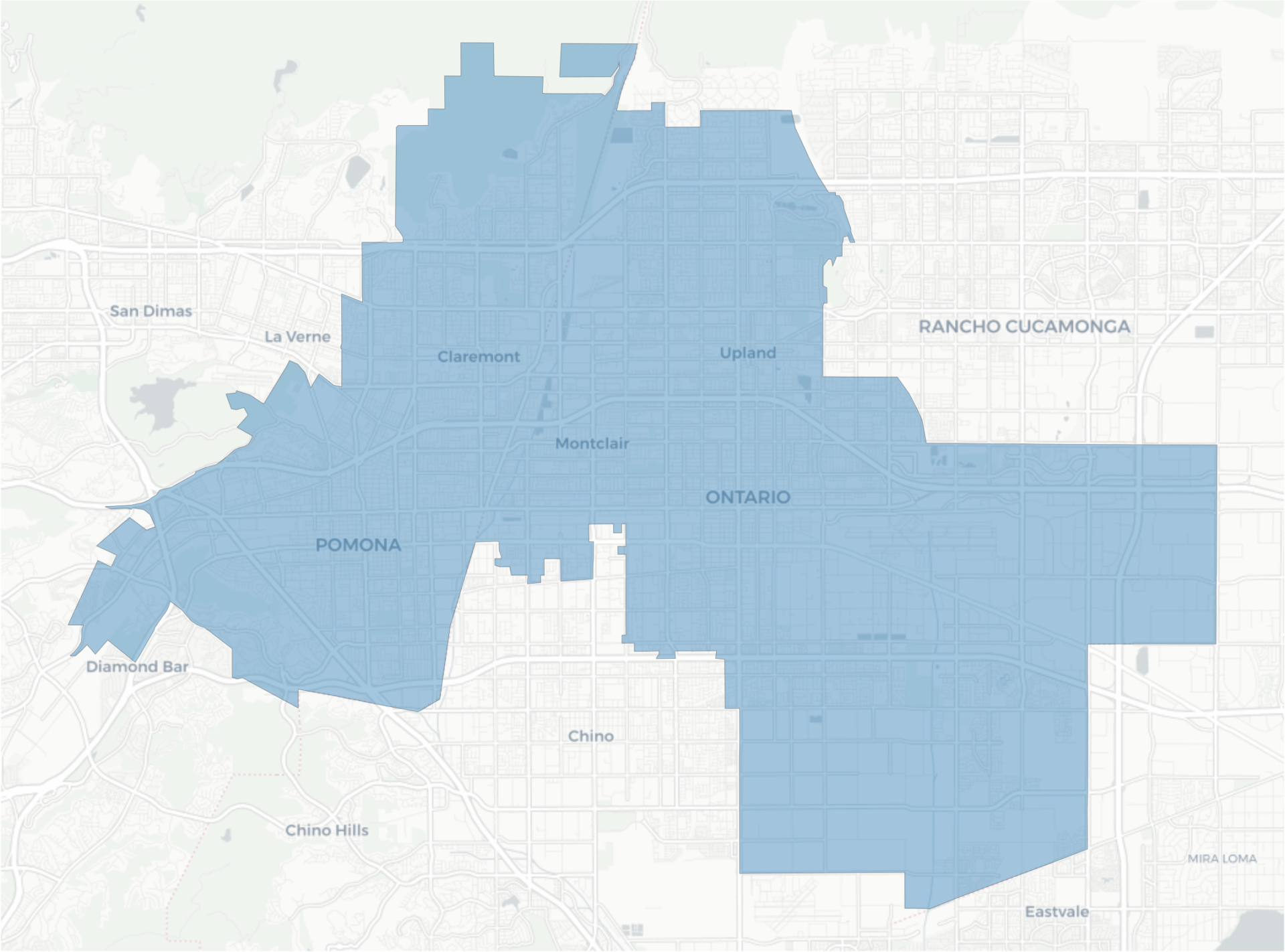
- Pomona, Claremont, Upland, Montclair, and Ontario.
- San Gabriel Valley: I-210 corridor from Pasadena to Clairemont, except for Irwindale.
- San Gabriel Valley: I-210 corridor from Pasadena to Clairemont plus the Angeles Mountains.
- San Gabriel Valley: I-210 corridor from Azusa to Clairemont plus West Covina and Covina.
- San Gabriel Valley: Glendora, Azusa, Irwindale, Baldwin Park, West Covina, Covina, and small cities.
- San Gabriel Valley: Sierra Madre to the northwest, Monterey Park to the southwest, La Puente to the southeast, and Duarte to the northeast.
- San Gabriel Valley: San Marino to the northwest, Monterey Park to the southwest, I-605/I-10 junction to the southeast, and Arcadia to the northeast.


Leave a Reply